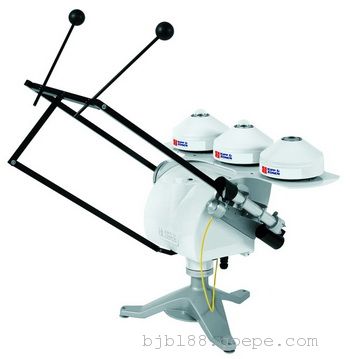
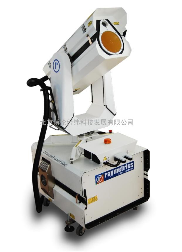
3D Aerosol LIDAR
三维气溶胶激光雷达
(型号:ESS-D200)
1、设备简介
希腊Raymetrics气溶胶激光雷达系统采用世界*先进的激光雷达制造工艺,利用不同波段激光信号探测大气气溶胶、水汽等垂直阔线,可以实时探测能见度和云底高度等,结合3D扫描技术,可以探测污染物的浓度分布及来源。探测包括气溶胶、能见度、水汽、火山灰、烟雾、污染来源、云底高度、边界层高度、光学厚度、消光系数、后向散射系数、色比等。
其客户遍布美国、中国、印度、欧洲、南亚、非洲和南美等地区,应用单位包括中国科学院、美国气象局、英国气象局、韩国气象局、空管局、欧空局、德国宇航中心、北京大学、南京大学等,应用领域包括气象、环境、航空、军事等科研和应用等。
希腊Raymetrics可以根据用户实际需要进行量身定制,例如,ESS-D200型激光雷达用于探测雾、能见度及污染物来源等;ESS-D300型激光雷达则用于探测火山灰、气溶胶及边界层高度等;ESS-D400型激光雷达则用于探测水汽浓度垂直阔线等。在这些应用中,可以根据探测的范围和内容,定制激光器的功率、激光波长、交叉极化波长、拉曼、镜头尺寸等,扫描模式也可以选择垂直观测或三维扫描等方式。
产品通过ISO 9001:2008体系认证,性能及指标满足欧洲气溶胶研究激光雷达观测网(EARLINET)需求,自2012年以来参与了全球上百个大型科学研究计划,在大气科学、天气预报、环境治理、航空气象、空间科学等领域发挥了卓越贡献。
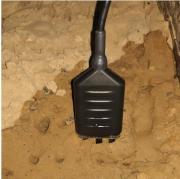
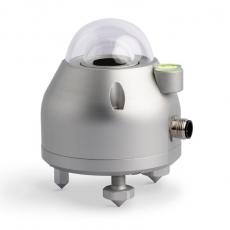
ESS-D200型三维扫描气溶胶激光雷达,拥有大功率激光器、大口径望远镜及全3D扫描方式,可以为航空环境预报及预警提供重要的气象参数,探测要素包括:能见度、雾、污染物来源及云底高度等,是市场上*优秀的气溶胶雷达系统。
2、ESS-D200雷达主要功能
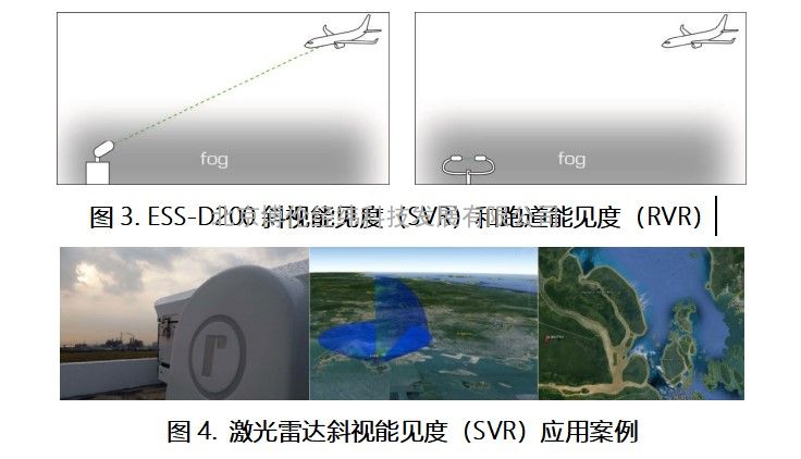
(1)能见度监测:
该雷达系统可以提供斜视能见度(SVR),与跑道能见度(RVR)相比,斜视能见度更能真实的反映飞行员的视觉感受。
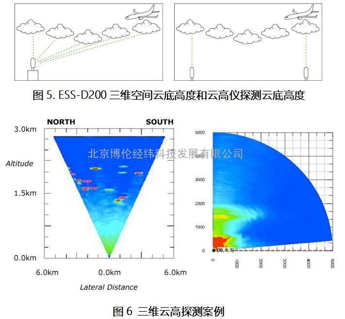
(2)云底高度监测:
该雷达系统可以提供三维空间云底高度,可以更真实的反映整个机场上空云的三维分布,而普通的云高仪采样空间仅为其头顶上方狭小的区域。
(3)雾霾监测:
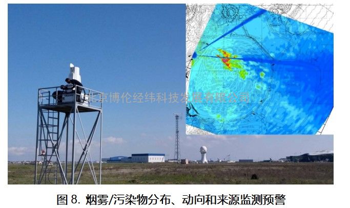
该雷达系统可以监测平流雾的分布、动向及来源,可以为航空预警提供预报服务。
(4)气溶胶类型甄别:
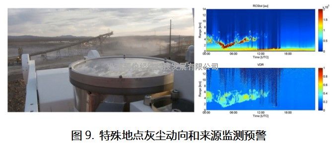
该雷达系统可以区分火山灰气溶胶、天然灰尘、烟雾、海洋气溶胶、冰云、水云等成分,为航空环境预警提供有力技术保障。
3、ESS-D200雷达输出产品
气溶胶、气溶胶类型、能见度、云底高度、边界层高度、光学厚度、消光系数、后向散射系数、色比等。3D扫描方式,探测距离10-15km,可以为航空环境预报及预警提供重要的气象参数。
4、ESS-D200雷达主要特点
(1)激光能量:在355nm单脉冲能量可达~30mJ;
(2)200mm大口径望远镜,有效提升信号效率;
(3)优秀的信噪比,探测距离可达10~15km;
(4)系统可以全自动远程控制;
(5)系统包含标准软件包:雷达控制、数据分析和实时显示及存储。
(6)符合欧盟标准人眼安全等级60825-1:2007;
(7)兼容欧洲气溶胶研究激光雷达观测网(EARLINET)要求;
(8)品质保证:ISO9001:2008管理体系认证;
(9)应用领域:气象、环境、航空、军事、科学研究等。
4技术指标:
扫描范围:10-15km
标准检测波长:355 nm co-polar
可拓展监测波段:355 nm cross-polar
387 nm nitrogen Raman
分辨率:7.5m
采样时间分辨率:1秒或者10秒等多种采样方式
FWHM 带宽近似:~0.5 nm per wavelength
激光能量:30MJ/每脉冲@355nm
重复率:20Hz
光束扩展:X10
检测模式:近场和远场测量的模拟和光子计数
3D扫描范围:方位角0~357°;天顶角0~90°
内部PC:工业级PC运行窗口
气候控制:激光雷达头和控制单元的加热和空调单元
软件功能:仪表控制、测量调度、系统对齐和设置程序、数据采集、数据存储(数据库)、数据分析、数据可视化
尺寸(主镜):200毫米
视场(FOV):0.25至3 MRAD(用户可调)
重叠:<200 m(带工厂设置FOV)
电源:110 - 240 V, 50 - 60 Hz
功耗:25 Amps.
尺寸:约1.8 m×1 m×1 m(HXWXD)
重量:约220公斤
自动化:自动化提供远程可操作的测量调度
保修:1年为标准
技术配件和维护:3天现场安装培训课程标准
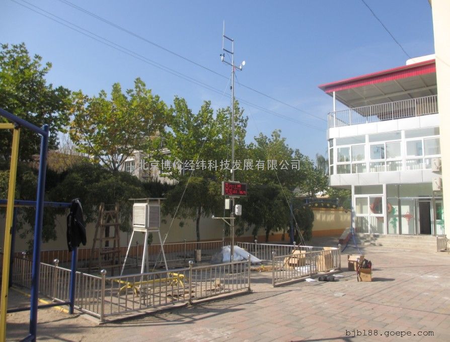
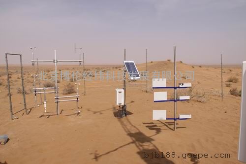
5、ESS-D200应用案例
[1] de Miranda, R.M., et al. (2017): The relationship between aerosol particles chemical composition and optical properties to identify the biomass burning contribution to fine particles concentration: a case study for São Paulo city, Brazil, Environ Monit Assess, 189: 6. https://doi.org/10.1007/s10661-016-5659-7
[2] Gouveia, D. A., et al. (2017): Optical and geometrical properties of cirrus clouds in Amazonia derived from 1 year of ground-based lidar measurements, Atmos. Chem. Phys., 17, 3619-3636, https://doi.org/10.5194/acp-17-3619-2017
[3] Dorman C.E. (2017): Early and Recent Observational Techniques for Fog. In: Koračin D., Dorman C. (eds) Marine Fog: Challenges and Advancements in Observations, Modeling, and Forecasting. Springer Atmospheric Sciences. Springer, Cham
[4] Chilinski, M.T., et al. (2016): Modelling and Observation of Mineral Dust Optical Properties over Central Europe, Acta Geophys. 64: 2550. https://doi.org/10.1515/acgeo-2016-0069
[5] Guerrero-Rascado, J. L., and Coauthors (2016): Latin American Lidar Network (LALINET) for aerosol research diagnosis on network instrumentation. J. Atmos. Sol.-Terr. Phys., 138–139, 112–120, doi:https://doi.org/10.1016/j.jastp.2016.01.001.
[6] George Georgoussis et al. (2016): Signal to Noise Ratio Estimations for a Volcanic Ash Detection Lidar. Case Study: the Met Office, EPJ Web of Conferences 119, 07002, DOI: 10.1051/epjconf/201611907002
[7] F. Tan et al. (2015): Monsoonal variations in aerosol optical properties and estimation of aerosol optical depth using ground-based meteorological and air quality data in Peninsular Malaysia, Atmos. Chem. Phys., 15, 3755–3771, 2015, doi:10.5194/acp-15-3755-2015
[8] Mbengue, S., Alleman, L.Y. & Flament, P. (2015): Bioaccessibility of trace elements in fine and ultrafine atmospheric particles in an industrial environment, Environ Geochem Health, 37: 875. https://doi.org/10.1007/s10653-015-9756-2
[9] Rose, C., et al. (2015): Major contribution of neutral clusters to new particle formation at the interface between the boundary layer and the free troposphere, Atmos. Chem. Phys., 15, 3413-3428, https://doi.org/10.5194/acp-15-3413-2015
[10] Barbosa, H. M. J., et al (2014): A permanent Raman lidar station in the Amazon: Description, characterization and first results. Atmos. Meas. Tech., 7, 1745–1762, doi:https://doi.org/10.5194/amt-7-1745-2014.
[11] Granados-Muñoz, M. J., et al. (2014): Retrieving aerosol microphysical properties by Lidar-Radiometer Inversion Code (LIRIC) for different aerosol types, J. Geophys. Res. Atmos., 119, 4836–4858, doi:10.1002/2013JD021116.
[12] Papayannis A. et al. (2014): Optical, size and mass properties of mixed type aerosols in Greece and Romania as observed by synergy of lidar and sunphotometers in combination with model simulations: A case study, Science of the Total Environment, 500-501 (2014) 277-294,
[13] Zawadzka, O., Makuch, P., Markowicz, K.M. et al. (2014): Studies of aerosol optical depth with the use of Microtops II sun photometers and MODIS detectors in coastal areas of the Baltic Sea, Acta Geophys. 62: 400. https://doi.org/10.2478/s11600-013-0182-5
[14] Navas-Guzmán, F., D. et al. (2013): Eruption of the Eyjafjallajökull Volcano in spring 2010: Multiwavelength Raman lidar measurements of sulphate particles in the lower troposphere, J. Geophys. Res. Atmos., 118, 1804–1813, doi:10.1002/jgrd.50116.
[15] Estellés, V., et al. (2012): Study of the correlation between columnar aerosol burden, suspended matter at ground and chemical components in a background European environment, J. Geophys. Res., 117, D04201, doi:10.1029/2011JD016356.
[16] Granados-Muñoz, M. J., et al. (2012): Automatic determination of the planetary boundary layer height using lidar: One-year analysis over southeastern Spain, J. Geophys. Res., 117, D18208, doi:10.1029/2012JD017524.
[17] Hervo, M., et al.(2012), and Sellegri, K.: Physical and optical properties of 2010 Eyjafjallajökull volcanic eruption aerosol: ground-based, Lidar and airborne measurements in France, Atmos. Chem. Phys., 12, 1721-1736, https://doi.org/10.5194/acp-12-1721-2012
[18] Pérez-Ramírez, D., et al. (2012): Retrievals of precipitable water vapor using star photometry: Assessment with Raman lidar and link to sun photometry, J. Geophys. Res., 117, D05202, doi:10.1029/2011JD016450.
[19] Zieliński, T., Petelski, T., Makuch, P. et al. (2012): Studies of aerosols advected to coastal areas with the use of remote technique, Acta Geophys. 60: 1359. https://doi.org/10.2478/s11600-011-0075-4
[20] Boulon, J., et al. (2011): Investigation of nucleation events vertical extent: a long term study at two different altitude sites, Atmos. Chem. Phys., 11, 5625-5639, https://doi.org/10.5194/acp-11-5625-2011, 2011.
[21] Córdoba-Jabonero, C., et al. (2011): Synergetic monitoring of Saharan dust plumes and potential impact on surface: a case study of dust transport from Canary Islands to Iberian Peninsula, Atmos. Chem. Phys., 11, 3067-3091, https://doi.org/10.5194/acp-11-3067-2011
[22] Guerrero-Rascado, J. L., et al. (2011): Aerosol closure study by lidar, Sun photometry, and airborne optical counters during DAMOCLES field campaign at El Arenosillo sounding station, Spain, J. Geophys. Res., 116, D02209, doi:10.1029/2010JD014510.
[23] Themistocleous K. et al. (2010): Monitoring Air Pollution in the Vicinity of Cultural Heritage Sites in Cyprus Using Remote Sensing Techniques. In: Ioannides M., Fellner D., Georgopoulos A., Hadjimitsis D.G. (eds) Digital Heritage. EuroMed 2010. Lecture Notes in Computer Science, vol 6436. Springer, Berlin, Heidelberg
[24] George Georgoussis et al. (2009): Continuous measurements of PM at ground level over an industrial area of Evia (Greece) using synergy of a scanning Lidar system and in situ sensors during TAMEX campaign, EMS Annual Meeting Abstracts, Vol. 6, EMS2009-309-5, 2009, 9th EMS / 9th ECAM
[25] Guerrero-Rascado, J. L., et al. (2009): Extreme Saharan dust event over the southern Iberian Peninsula in september 2007: active and passive remote sensing from surface and satellite, Atmos. Chem. Phys., 9, 8453-8469, https://doi.org/10.5194/acp-9-8453-2009
[26] Kazadzis, S., et al. (2009): Spatial and temporal UV irradiance and aerosol variability within the area of an OMI satellite pixel, Atmos. Chem. Phys., 9, 4593-4601, https://doi.org/10.5194/acp-9-4593-2009
[27] Amiridis, V., et al. (2007): Aerosol Lidar observations and model calculations of the Planetary Boundary Layer evolution over Greece, during the March 2006 Total Solar Eclipse, Atmos. Chem. Phys., 7, 6181-6189, https://doi.org/10.5194/acp-7-6181-2007
[28] Papayannis, A., et al. (2007): Extraordinary dust event over Beijing, China, during April 2006: Lidar, Sun photometric, satellite observations and model validation, Geophys. Res. Lett., 34, L07806, doi:10.1029/2006GL029125.
 扫一扫,手机浏览
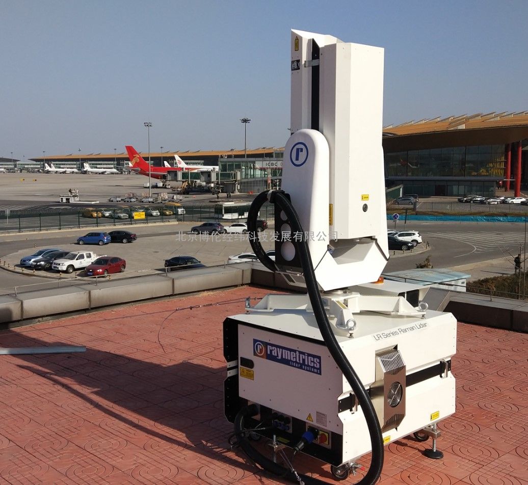


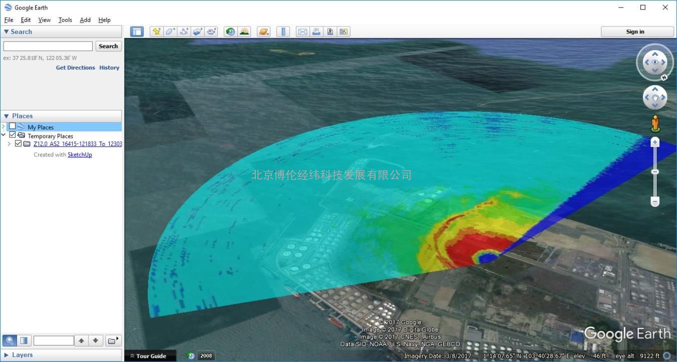 5、ESS-D200应用案例